Using Artificial Intelligence systems to identify, especially in historic city centres, the most accessible routes for elderly people and people with motor disabilities: this is the aim of the research work of Daniele Treccani, a young researcher at the Unesco Research Lab in Mantua of Politecnico di Milano.
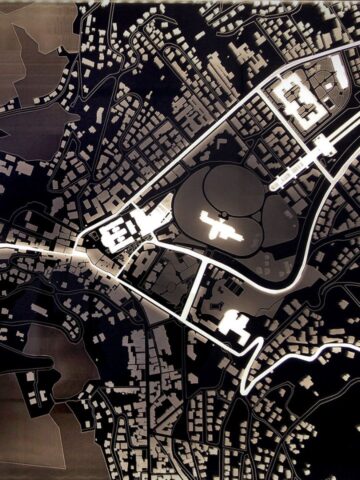
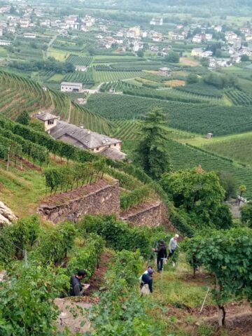
The research, published in the International Journal of Applied Earth Observation and Geoinformation, used a mobile mapping system (in this specific case, a car equipped with instrument provided by Leica Geosystems Italia) for surveying and mapping the small town of Sabbioneta, which has been, together with Mantua, a UNESCO World Heritage Site since 2008 and is an emblematic example of a Renaissance village enclosed within historic walls.
Machine Learning was used to automatically detect the differences between streets and pavements made of pebbles, cobblestones and bricks, with widely varying heights and widths, which on the one hand distinguish and are typical of historical cities and on the other hand make moving difficult for people with motor disabilities. The good reliability rate of the data obtained (89%) was verified on site; this allowed using it for designing a map of the most accessible routes.
Starting from the collected data or point clouds, namely millions and millions of points distributed in the surveyed space that allow us to obtain measures and three-dimensional representations of what surrounds us, for instance houses, streets, squares, pavements and various objects, it is possible to identify, with the help of Machine Learning, the most accessible trajectories and paths in a historical urban context. The work on Sabbioneta made it possible to test and demonstrate the importance of AI methods for managing accessibility in historic city centres.
Daniele Treccani, researcher of the Department of Architecture, Built Environment and Construction Engineering
The automatic extraction of geometric and space georeferenced information can be extended to other urban elements and be used for tourism accessibility and navigation applications, as well as for the creation of map bases for Plans for the Elimination of Architectural Barriers (PEBA) or Urban Accessibility Plans. More in general, the data collected and processed can be useful for the construction of City Models and digital models of historic city centres.
Daniele Treccani is currently working on extending his research to data from other urban survey systems, such as UAS (drone) photogrammetry, laser scanner survey systems from aircrafts or with portable systems (backpacks or handheld), and continues his collaboration with the University of Vigo (Spain), with which he carried out part of the research.
Machine Learning (ML) allows a complex neural network attempting to simulate the functioning of the human brain, to “learn” from a large amount of data previously structured by an operator. After the learning phase, it is possible, through a combination of inputs, to recognise and classify objects within the data, automatically and with no human intervention.
Andrea Adami, Professor of Topography and Cartography